Save articles for later
Add articles to your saved list and come back to them any time.
There would be fewer cars on major city streets under a new City of Melbourne proposal that would discourage people from driving through the CBD and prioritise pedestrians.
Closing some roads to private vehicles between set times each day and restricting car access to a single direction along others are key proposals in the scheme to make the city more walkable.
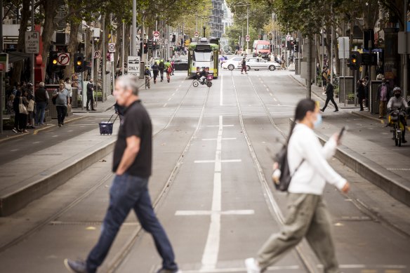
More major Melbourne CBD streets could often close to private cars during certain periods, similar to lanes near Swanston Street, under a Melbourne council draft plan.Credit: Chris Hopkins
The Future Streets Framework will be considered by councillors at the Future Melbourne Committee next month, a precursor to community consultation and a formal council vote.
The draft plan proposes creating several “Melbourne Square” streets near train stations that could be fully or partially closed at certain times to non-essential vehicles.
The entirety of Elizabeth Street within the CBD would primarily encourage tram, bicycle, essential vehicle and pedestrian traffic to make the city’s busiest streets more safe and welcoming for walkers.
Sections of Flinders, Spencer, Spring, Collins, Bourke and William streets near transport hubs and prominent civic spots could also block car access to a single direction at times or close entirely for short peak-hour periods, to support more efficient transport interchange and open spaces.
The proposal suggests that greater access to the “Melbourne Square” streets could be provided for loading, while emergency services are deemed essential and could use the streets at all times.
Lord Mayor Sally Capp said projects such as the Metro Tunnel were expected to bring half a million more passengers a week into the city, and the council wanted to prioritise safe pedestrian movement around these transport hubs.
Capp singled out areas near Southern Cross Station and Flinders Street Station, which is close to the future Town Hall station.
“The majority of trips completed within the Hoddle Grid are on foot, so we’re particularly focused on making our streets as safe for pedestrians as possible,” Capp said. “We will continue making Melbourne a more walkable city, which means ensuring pedestrians and cars can safely coexist.”
Melbourne Squares would be “iconic destinations, celebrating the quintessentially Melbourne characteristics of the city” with trams, art and heritage buildings, the proposal said.
The framework released on Friday afternoon acknowledges vehicles that have a city destination can provide an economic contribution to the CBD, but notes that “vehicles that simply travel through the city do not provide a benefit”.
“Pedestrians of all abilities offer the highest economic and environmental return of any transport mode,” the draft framework says.
Victoria Walks executive officer Ben Rossiter said this was the kind of thing the world’s best cities do.
He said the proposal would address tram stops such as Collins Street near Swanston Street, which can be so overcrowded that people can’t move along the platform to catch a tram, particularly disadvantaging the elderly and disabled people.
“Redesigning the streets around trains stations into squares is precisely what needs to happen for the city to function smoothly and work for everyone,” he said. “This is about creating streets where people can walk, talk, stop and play which supports businesses and the city’s economy.”
However, Transport Workers’ Union Victorian assistant secretary Mem Suleyman said limited loading zones and truck access on Exhibition Street due to the City of Melbourne’s bike lanes was already a “debacle” that disrupted delivery drivers.
“It is crucial that any further redevelopment projects for Melbourne streets have at the forefront plans to improve access and safety for essential transport services like the delivery of goods and passenger transport,” she said.
King, Victoria, Lonsdale, Latrobe, Queen, Russell and Exhibition streets would maintain through access for vehicles under the draft plan, which also forms part of the council’s 2030 transport strategy alongside a review of the Melbourne’s “Little” streets and an Elizabeth Street feasibility study.
The “Little” street review released in March found attempts to the turn roads such as Little Collins Street into pedestrian-friendly promenades were failing because motorists refuse to share the busy laneways and obey new speed limits.
In addition to occasionally car-free Melbourne Squares, the draft street plan categorises all CBD streets into one of; city streets with trams (such as part of Flinders Street with high-amenity kerbside space); city streets with buses (such as part of Russell Street which would prioritise bus lanes); city streets with bikes (such as sections of Exhibition Street with widened footpaths); Little streets (such as sections of Flinders Lane with public art); and laneways (such as Degraves Street with outdoor dining).
The framework also includes central (near Flinders Street station), south-east (near Parliament), north (near Flagstaff station), north-east (near Melbourne Central station), south-west (near Southern Cross station) and north-west (near the court precinct) zones that would inform street design.
If endorsed at a June 6 council committee meeting, community consultation on the framework will run from June 7 to July 19 via the city council’s online platform.
The Morning Edition newsletter is our guide to the day’s most important and interesting stories, analysis and insights. Sign up here.
Most Viewed in National
From our partners
Source: Read Full Article


